About this book series
Remote Sensing and Digital Image Processing book series. Remote sensing is the acquisition of Physical data of an object without touch or contact. Earth observation satellites have been used for many decades in a wide field of applications. With the advancements in sensor technology, earth imaging is now possible at an unprecedented level of detail. Imaging spectrometers and thermal multispectral systems acquire detailed spectroscopic information of physical properties of the earth's surface. Dynamic processes can now be studied with interferometric systems. SAR interferometry, laser altimetry and high-resolution imaging allow a very detailed, three-dimensional reconstruction of the earth surface. With the advent of multi-sensor mission comes a new era of imaging, opening the possibility of integrating date from various sensor systems. The books published in the series explore these topics in remote sensing and provide a framework for related advanced digital image processing approaches.
Series Editorial
Advisory Board:
Michael Abrams, NASA Jet Propulsion Laboratory, Pasadena,
CA, USA
Paul Curran, City University London, UK
Arnold Dekker, CSIRO Land and Water Division, Canberra, Australia
Steven M. de Jong, Utrecht University, The Netherlands
Michael Schaepman, University of Zurich, Switzerland
Accepted for inclusion in Scopus.
- Electronic ISSN
- 2215-1842
- Print ISSN
- 1567-3200
- Series Editor
-
- Freek D. van der Meer
Book titles in this series
-

-
Polarimetric Synthetic Aperture Radar
Principles and Application
- Editors:
-
- Irena Hajnsek
- Yves-Louis Desnos
- Open Access
- Copyright: 2021
Available Renditions
- Hard cover ( Book w. online files / update )
- eBook

-
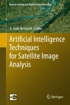
Artificial Intelligence Techniques for Satellite Image Analysis
- Editors:
-
- D. Jude Hemanth
- Copyright: 2020
Available Renditions
- Hard cover
- Soft cover
- eBook

-
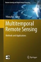
Multitemporal Remote Sensing
Methods and Applications
- Editors:
-
- Yifang Ban
- Copyright: 2016
Available Renditions
- Hard cover
- Soft cover
- eBook

-
Understanding Earth Observation
The Electromagnetic Foundation of Remote Sensing
- Authors:
-
- Domenico Solimini
- Copyright: 2016
Available Renditions
- Hard cover
- Soft cover
- eBook

Abstracted and indexed in
-
- EMBiology
- SCImago
- SCOPUS
